


Guidebook with maps/step-by-step
Access to the Cross-Country Ski Center of La Ruchère / Gîte de la Ruche:
On the road to the gorges of Guiers Vif, between Saint-Christophe-sur-Guiers and Saint-Pierre-d’Entremont (D520c), take the road that climbs toward La Ruchère. Drive up to the La Ruchère cross-country ski center and park in the large parking lot.
(1) From the parking lot, facing the cross-country ski center, take the path on the right towards "Col de la Sariette" and "Riondettes." This yellow-marked trail goes into the forest to the northwest. After 300 meters, follow the forest track on the left. The route now heads towards the Rochers du Quartier in a southwest direction. After a short ascent, leave a path that branches off to the right and continue straight following the markings. Cross a clear-cut area after which the path narrows.
(2) At an altitude of 1,200 m, the path widens again. Take a sharp turn to the left, then a descending turn to the right. The path climbs again to the Rochers du Quartier (rocky outcrops below). Leave a path that branches off to the left. Reach a crossing (Forêt du Quartier): continue to the right towards "Col de la Sariette" and "Riondettes." Leave a path on the left and follow the sign for "Belvédère du Pertuis."
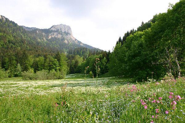
(3) From there, a wide view opens up over the Guiers valley, Saint-Laurent-du-Pont, and Grande Sure. Continue by returning along a small path to the left of the belvedere.
(4) A small ascent leads close to the Col de la Sariette. Follow the direction "Les Riondettes" and "Nordic Center by La Morte." A small path between the rocks leads to a track that descends to the Riondettes parking lot. Take the road that goes north for about twenty meters, then the path on the right (direction "La Morte"). After a small bridge, continue along the small stream towards the Nordic Center. Cross the Pré de la Morte to reach a path that runs along the rocks in front.
(5) Continue north and take the small path that ascends to the right (yellow markings) leading to Cernay, where you will find the GR de Pays du Tour de Chartreuse (yellow and red markings). Continue to the left towards the "Nordic Center." Approaching rocky outcrops, the path descends on the left. It continues north along a logging track until it reaches the Nordic center of La Ruchère.
On the road to the gorges of Guiers Vif, between Saint-Christophe-sur-Guiers and Saint-Pierre-d’Entremont (D520c), take the road that climbs toward La Ruchère. Drive up to the La Ruchère cross-country ski center and park in the large parking lot.
(1) From the parking lot, facing the cross-country ski center, take the path on the right towards "Col de la Sariette" and "Riondettes." This yellow-marked trail goes into the forest to the northwest. After 300 meters, follow the forest track on the left. The route now heads towards the Rochers du Quartier in a southwest direction. After a short ascent, leave a path that branches off to the right and continue straight following the markings. Cross a clear-cut area after which the path narrows.
(2) At an altitude of 1,200 m, the path widens again. Take a sharp turn to the left, then a descending turn to the right. The path climbs again to the Rochers du Quartier (rocky outcrops below). Leave a path that branches off to the left. Reach a crossing (Forêt du Quartier): continue to the right towards "Col de la Sariette" and "Riondettes." Leave a path on the left and follow the sign for "Belvédère du Pertuis."
(3) From there, a wide view opens up over the Guiers valley, Saint-Laurent-du-Pont, and Grande Sure. Continue by returning along a small path to the left of the belvedere.
(4) A small ascent leads close to the Col de la Sariette. Follow the direction "Les Riondettes" and "Nordic Center by La Morte." A small path between the rocks leads to a track that descends to the Riondettes parking lot. Take the road that goes north for about twenty meters, then the path on the right (direction "La Morte"). After a small bridge, continue along the small stream towards the Nordic Center. Cross the Pré de la Morte to reach a path that runs along the rocks in front.
(5) Continue north and take the small path that ascends to the right (yellow markings) leading to Cernay, where you will find the GR de Pays du Tour de Chartreuse (yellow and red markings). Continue to the left towards the "Nordic Center." Approaching rocky outcrops, the path descends on the left. It continues north along a logging track until it reaches the Nordic center of La Ruchère.
