


Guidebook with maps/step-by-step
(1) This round trip starts at the Villar’s car park in the village of Miribel-les-Échelles. On this itinerary, follow the orange signs (local marked path). Follow the direction of Notre-Dame du Château. Pass by the Croix St Maurice, then turn left to La Grotte du Loup. You leave the road for a path, which enters a field with cows. Mind to close all the fences behind you, keep your dog on a leash, and stay on the path. Do not yell and do not make sudden movements. Stay on the path going down in the undergrowth. On your left, you find a first local curiosity: a basin.
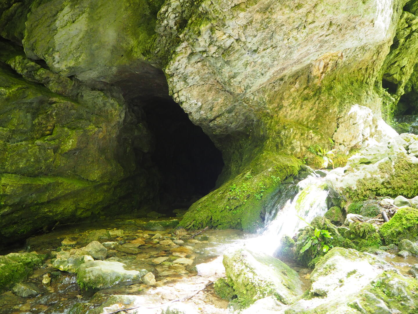
(2) At the junction, turn left towards La Grotte du Loup. After crossing the stream, on the right by a steep way down, you can go back and forth to the Grotte du Loup. Back on the main path, keep walking in the undergrowth. You pass by the Croix des Combes, perched on its rock. After crossing the stream, go straight ahead on the main path. Cross a bridge.
(3) At the fork of La Roche qui Pleure, take the path on the right. Cross another bridge: the Pont des Combes. Stay on the path and enjoy the nice views on the Chartreuse’s peaks (Mount Beauvoir and Mount Outheran) and the countryside. Cross another stream: ruisseau du Chenevas (be careful when you cross, makeshift bridge). The route is going up through open places and in the undergrowth.
(4) At the junction turn right: beautiful views on the countryside and the peaks of Chartreuse. At the next fork, Panneau le Chaboud 520m, take the road that goes down on the left and that brings you to the hamlet Sous-le-bois. Cross the hamlet and, at the junction with the Chemin de Pierrafite, take the small path that goes up on the right.
(5) After a way up at the edge of the fields you meet the road that brings you back to the Villar’s car park.
