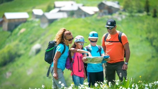
The Chartreuse massif is a Regional Natural Park, so there are certain regulations concerning the presence of dogs in certain protected areas, but don’t panic! Here is all the information that will allow you to walk in peace with your faithful companion!
St Hugues
Nature walks
Where to hike with your dog
Regulations on the Chartreuse massif
In general, you can walk with your dog, kept on a leash, throughout the Chartreuse massif except:
- on the Hauts de Chartreuse Nature Reserve, all year round. more info on the Nature Reserve
- on the mountain pastures but the ban is only from June 10 to October 15, access is free the rest of the year.
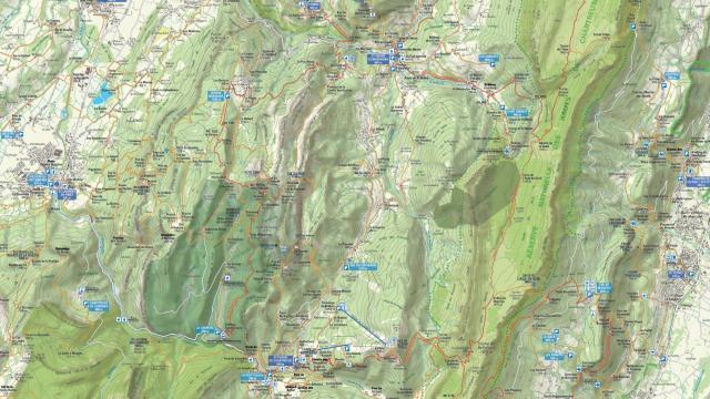
Find below the mountain pastures affected by this temporary ban:

Carte Interdiction Chiens 2018
Certain hikes and walks are not subject to these prohibitions. Even in summer you can access the following routes:
Accessible hikes with a dog
Le Cirque de St Même :exceptional natural site at the foot of the Hauts de Chartreuse Nature Reserve, the Cirque de St Même, source of the Guiers Vif, offers a family walk between forest and torrent, to discover the waterfalls.
Elevation: 150 m / Level: easy / Duration: 1h
>> Consult the complete topo of the hike “The waterfalls of the Cirque de St Même”
La Pinéa (summit) :With its 1771m of altitude, it has everything of a big one and taunts its neighbors, the Charming Som et Chamechaude. This slightly aerial summit offers a real mountain hike but accessible with a superb 360 ° panorama
Elevation: 400 m / Level: medium / Duration: 2h30
>> Consult the complete topo of the hike “La Pinéa”
La Grande Sure (summit) :From St Laurent du Pont or from Col de la Charmette
Elevation: 1510 m or 830 m (depending on the chosen departure) / Level: difficult / Duration: 8h or 5h30 (depending on the chosen departure)
>> Consult the complete topo of the hike “La Grande Sure from St Laurent du Pont”
Le Mont Grêle (sommet) :Mont Grêle (1425m) is located on the Epine chain which, geologically, belongs to the Jura massif. This small ascent offers an exceptional panorama on Lac d’Aiguebelette.
Elevation: 800m / Level: difficult / Duration: 5h
>> Consult the complete topo of the hike “Le Mont Gêle”
Le Belvédère d’Arpison :Loop for experienced walkers to do during the day. From the organ point, a magnificent view of the monastery of Currière.
Elevation: 850 m / Level: difficult / Duration: 5 hours
>> Consult the complete topo of the hike “Le Belvédère d’Arpison”
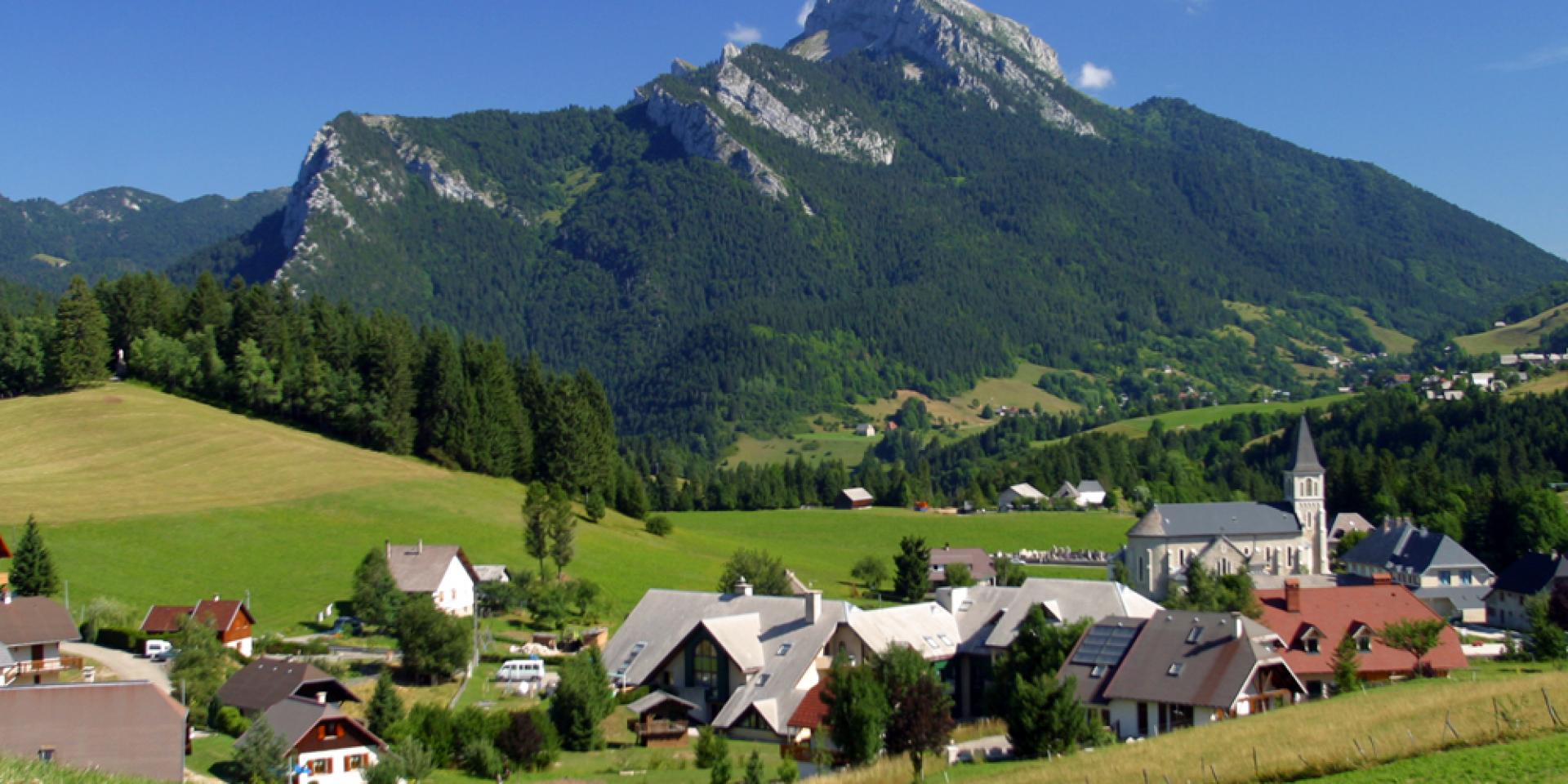
St Hugues en Chartreuse :At the foot of 3 emblematic peaks of the massif (Chamechaude, Charmant Som and Grand Som), the plateau of St Hugues is an ideal site for the family walk and the discovery of mountain agriculture.
Elevation: 180m / Level: very easy / Duration: 1h30
>> Consult the complete topo of the “St Hugues” hike
Chemin des Mules: Our route weaves its way between the two churches of St Pierre d’Entremont, before slipping into the Cozon valley, which bears witness to the Chartroussine agricultural traditions.
Elevation: 150m / Level: very easy / Duration: 2h
>> Consult the complete topo of the hike “Le Chemin des Mules”
The Entremont Desert: This short hike in the Entremonts Valley offers a discovery of the agricultural landscapes dominated by Mont Outhéran and Mont Granier.
Elevation: 330m / Level: easy / Duration: 3h
>> Consult the complete topo of the hike “Le Désert d’Entremont”
Béatrice de Savoie: This tour guides you through the lands of Béatrice de Savoie. From the commandery to the panoramic site of the chapel of the Madeleine, it is the rich past of the Ladders that you are invited to discover.
Elevation: 170m / Level: easy / Duration: 2h30
>> Consult the complete topo of the “Béatrice de Savoie” hike
Circuit des Dioux: This short hike starting from the St Hilaire du Touvet funicular conceals many surprises between the remarkable panorama of the Belledonne massif, the sky animated by the colors of paragliders and a getaway in the woods.
Elevation: 150m / Level: very easy / Duration: 1h30
>> Consult the complete topo of the “Circuit des Dioux” hike
Circuit of the Castle – Randocroquis: This circuit of discovery of the Castle is also a randocroquis offering artistic initiation workshops: drawing techniques, contrasts, perspectives and landscapes.
Elevation: 300m / Level: easy / Duration: 2h
>> Consult the complete topo of the “Circuit du Château – Randocroquis” hike
From Mont Charvais to Bec Corbeau: At the extreme north of the Massif de Chartreuse, this circuit overlooks the Combe de Chambéry and invites you to a peaceful stroll on the heights of St Baldoph which is one of the three communes of the Apremont vineyard.
Elevation: 460m / Level: medium / Duration: 4h
>> Consult the complete topo of the hike “From Mont Charvais to Bec Corbeau”
Cascade de la Pisserotte: This 64m high waterfall is easily accessible in 15min walk. It is particularly impressive in March / April with its strong flow of water due to snowmelt.
Elevation: 150m / Level: very easy / Duration: 0h20
>> Consult the complete topo of the “Cascade de la Pisserotte” hike
Cascade de l’Alloix and the paths of yesteryear: This refreshing hike offers a beautiful aquatic and forest atmosphere following a path that swings from one side of the torrent to the other to the Grande Cascade (more 43m).
Elevation: 250m / Level: easy / Duration: 2h
>> Consult the complete topo of the hike “Cascade de l’Alloix and the paths of the past”
Tour of the Aiguille de Quaix en Chartreuse: During this forest hike, you will discover another facet of the Chartreuse forests, through a Mediterranean-type forest due to its southern exposure.
Elevation: 600m / Level: medium / Duration: 3h
>> Consult the complete topo of the hike “Tour de l’Aiguille de Quaix en Chartreuse”
Côte Curt artistic trail: Artistic discovery trail. Along the way, you will discover sculptures made on the old Sardinian Way.
Elevation: 150m / Level: very easy / Duration: 1h30
>> Consult the complete topo of the “Artistic Trail of Côte Curt” hike
Col des Mille Martyrs: Facing La Grande Sure, this gentle hike offers an exceptional panorama of the Haute Chartreuse through meadows and forests.
Elevation: 290m / Level: easy / Duration: 3h30
>> Consult the complete topo of the “Col des Mille Martyrs” hike
The Old Black Forest of the Chapel of Merlas: A mixture of deciduous and coniferous trees, the old black forest offers a family walk in the “Charterhouse of the hills” and opens onto splendid panoramas on the western slope of the massif.
Elevation: 100m / Level: easy / Duration: 1h30
>> Consult the complete topo of the hike “The Old Black Forest of the Chapel of Merlas”
La Pointe de la Gorgeat: Varied trail between meadows, steep passages, ridges, magnificent panoramas of the Chartreuse, the Bauges and Mont Blanc. Warning: aerial route in certain places, to be avoided in case of bad weather.
Elevation: 820m / Level: Difficult / Duration: 5h
>> Consult the complete topo of the “Pointe de la Gorgeat” hike
If you wish, your dog can be pampered at the dog boarding “L’Élevage des Seigneurs de Montbel” while you hike on the other marked routes
Happy hikes to all!