


-
En live
1 - ski nordiqueMise à jour : 25 février 2025 - 12:54
- Col de Marcieu
- Col de Porte
- Le Désert d'Entremont
- Le Granier
- Le Sappey en Chartreuse
- St Hilaire du Touvet
- St Hugues / Les Egaux
- Le Planolet
WeatherTotal snow depthSki lifts0/4Mise à jour : 14 avril 2025 - 14:09 -
Book
online -
Shop
online
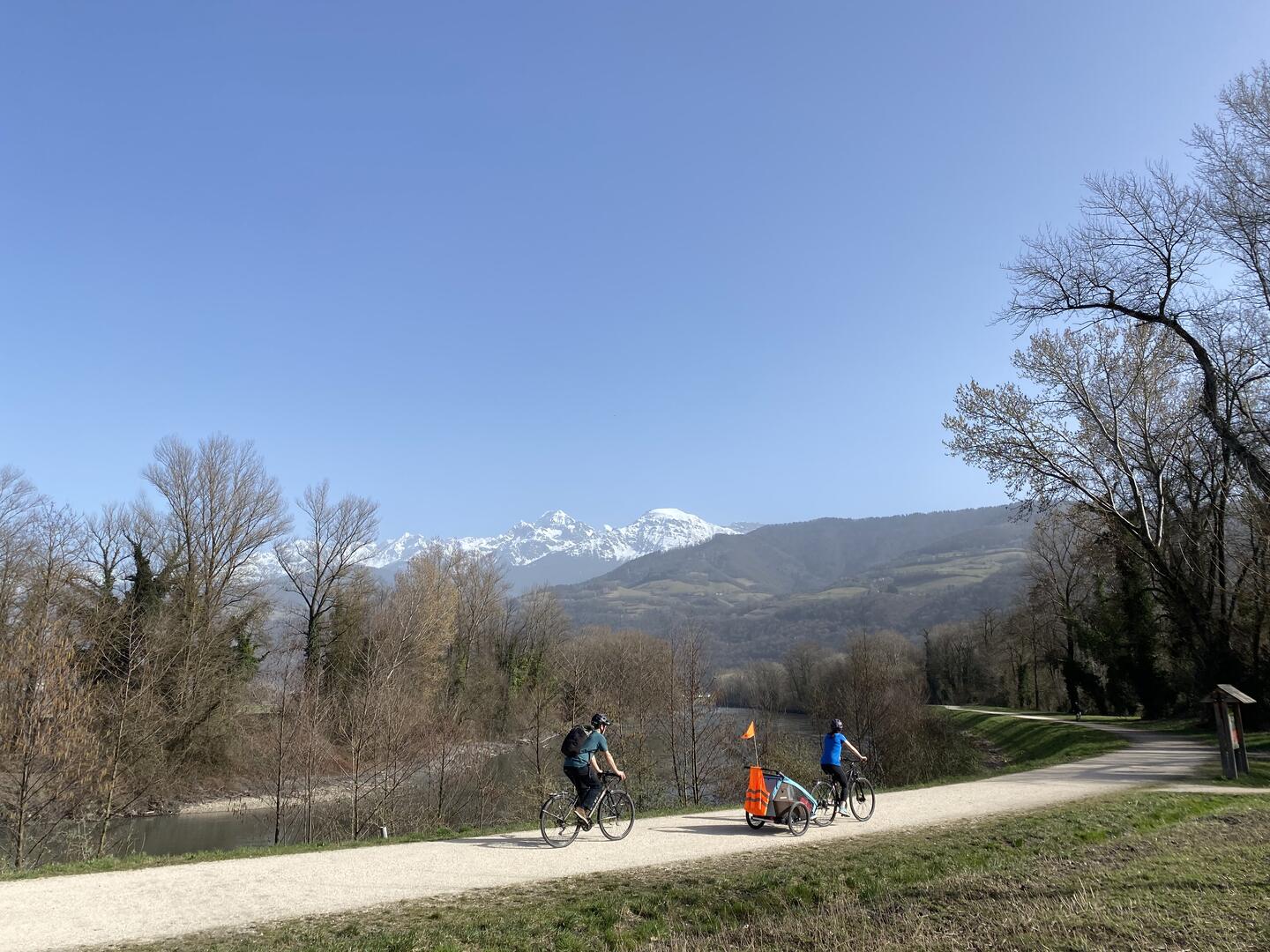
Parcours Mésange par les berges de l'Isère
Sport, Cycling sports, Miscellaneous sports, Greenway, Cycle tourism route
in Meylan
20.3
km
1h 15min
Easy
-
This cycling itinerary lets you pedal through nature, accompanied by birdsong and the sound of the river. A very pleasant ride just outside Grenoble.
-
The stretch from the Ile d'Amour to the Chemin des agriculteurs parking lot is white stabilized (very small gravel), but accessible to all types of bike.
The rest of the route is paved.
This route takes you past the Espace Naturel Sensible de La Taillat. This protected area is home to a wide variety of fauna (wood pigeon, oriole, beaver, etc.) and flora, often remarkable and rare.
A few recommendations:
- The riverbanks are shared: please be careful of other users, control your speed and...The stretch from the Ile d'Amour to the Chemin des agriculteurs parking lot is white stabilized (very small gravel), but accessible to all types of bike.
The rest of the route is paved.
This route takes you past the Espace Naturel Sensible de La Taillat. This protected area is home to a wide variety of fauna (wood pigeon, oriole, beaver, etc.) and flora, often remarkable and rare.
A few recommendations:
- The riverbanks are shared: please be careful of other users, control your speed and overtake carefully on the left.
- Under-age children are the responsibility of their parents or an accompanying adult. Please take care.
- A dyke is a protective structure against flooding. The routes take you along the banks of the Isère, so it is strictly forbidden to approach the riverbed, islands or gravel banks.
- Departure
- Meylan
-
-
Difference in height
- 105.667 m
-
-
-
Plain text period
- All year round.
-
-
-
Environment
-
-
-
Spoken languages
-
-
-
-
-
Documentation
- GPX / KML files allow you to export the trail of your hike to your GPS (or other navigation tool)
-
- See all reviews
- 106 meters of difference in height
-
- Maximum altitude : 238 m
- Minimum altitude : 214 m
- Total positive elevation : 106 m
- Total negative elevation : -106 m
- Max positive elevation : 15 m
- Min positive elevation : -15 m
Services
-
-
Accessibility
-
-
-
Equipment
-
-
-
Services
-

