


-
En live
1 - ski nordiqueMise à jour : 25 février 2025 - 12:54
- Col de Marcieu
- Col de Porte
- Le Désert d'Entremont
- Le Granier
- Le Sappey en Chartreuse
- St Hilaire du Touvet
- St Hugues / Les Egaux
- Le Planolet
WeatherTotal snow depthSki lifts0/4Mise à jour : 14 avril 2025 - 14:09 -
Book
online -
Shop
online
Le Col de la Ruchère
Sport, Winter sports, Snowshoe itinerary
in Saint-Christophe-sur-Guiers
6.7
km
3h 30min
Hard
-
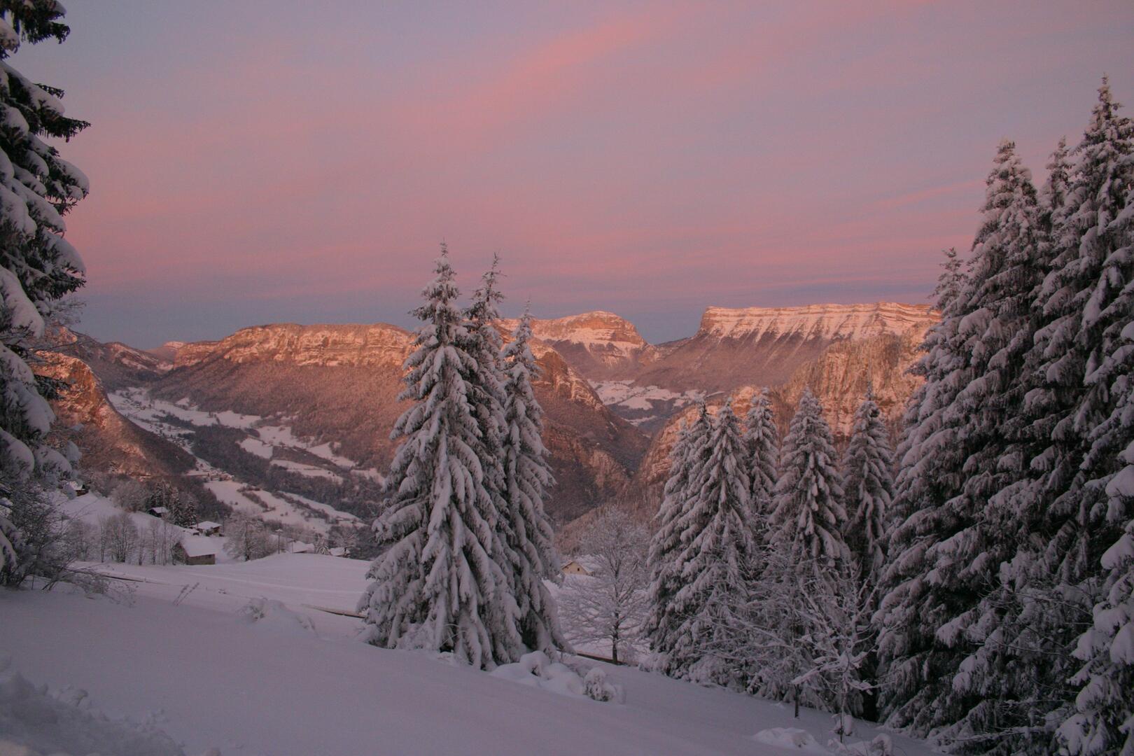
Starting from the Nordic site of La Ruchère, a secret, intimate route with views of the summits that are not to be missed. From the Col de la Ruchère you can admire Chamechaude, Grand Som and Petit Som.
-
From the Nordic site at La Ruchère, head up along the toboggan run to begin the ascent along the new GR. At Cernay, turn left to reach a flat area and then a meadow. Continue straight ahead to reach the entrance to the meadow leading to the Col de l'Aliénar. The loop continues at the edge of the forest on your right as you come down from this pass (or on your left if you don't take the time to climb it).
You arrive at the Tracol and continue straight on to reach the superb Col de la Ruchère...From the Nordic site at La Ruchère, head up along the toboggan run to begin the ascent along the new GR. At Cernay, turn left to reach a flat area and then a meadow. Continue straight ahead to reach the entrance to the meadow leading to the Col de l'Aliénar. The loop continues at the edge of the forest on your right as you come down from this pass (or on your left if you don't take the time to climb it).
You arrive at the Tracol and continue straight on to reach the superb Col de la Ruchère and its view of the 3 surrounding peaks. On the way back, turn right onto a wide track that leads back to Le Habert. Follow the road until you can turn left to climb back up through the meadow below the fireplace. A secret, intimate trail with unmissable views of the peaks.
- Departure
- Saint-Christophe-sur-Guiers
-
-
Difference in height
- 376.485 m
-
-
-
Plain text period
-
From 15/12 to 10/03.
Subject to favorable weather.
-
-
-
Environment
-
-
-
Spoken languages
-
-
-
-
-
Documentation
- GPX / KML files allow you to export the trail of your hike to your GPS (or other navigation tool)
-
- See all reviews
- 376 meters of difference in height
-
- Maximum altitude : 1470 m
- Minimum altitude : 1115 m
- Total positive elevation : 376 m
- Total negative elevation : -376 m
- Max positive elevation : 243 m
- Min positive elevation : -311 m
Services
-
-
Services
-


