


Guidebook with maps/step-by-step
Starting from Raidlight/Vertical, head towards Perquelin before turning right onto the bridge to enter the forest. At the Bois du Banc signpost, take the trail that climbs behind to reach the road above. When you cross the road, continue to the right towards the hamlet, which you’ll cross before joining a trail that climbs to the Les Antonins post after a slight dip.
At the next intersection, Sentier des Ravières, continue straight, and again go straight when you reach the forest track. Follow the same trail according to the markers until the next crossing with the forest track, where the trail continues straight ahead. The clearing known as Lentillère offers a first glimpse of Chamechaude and Charmant Som before plunging back into the heart of the Chartreuse forest.
At the direction post Sur Majeure, continue towards Sur Brévardière and proceed straight on a rolling trail. At the direction post La Pérelle, head towards Les Rajaches and then turn right to descend into a valley, enjoying the view of the hamlet of Garcinière. A short section of road leads you to a trail on your left, bringing you to the post Sur les Epallets. A beautiful but brief climb awaits you until you reach the direction post Le Clot, where you can enjoy a stunning view of the valley with Grand Som at the summit of the ski lifts at Les Egaux.
Next, take a long forest track that leads you to Cherlieu, which you will cross in the direction of the direction post Cherlieu-Calvaire for a pleasant downhill section for your legs. You’ll need to power up again to reach the hamlet of Les Egaux, which you’ll cross until you find yourself at the base of the ski lifts.
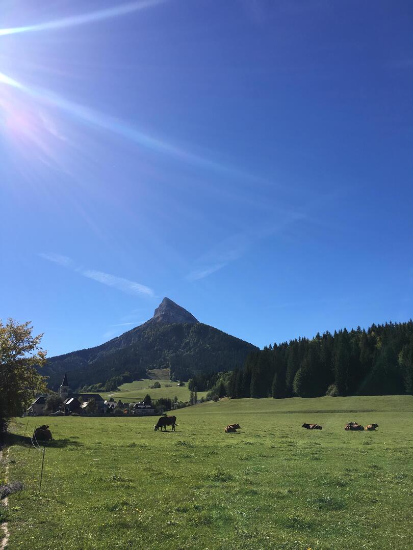
Continue left on the road, then right onto the departmental road, before heading left onto the trail that offers a unique view of Saint Hugues de Chartreuse and the surrounding mountains. At the Ancienne Route de Chartreuse post, continue right to join the departmental road and pass by the church of the hamlet, which has been the Arcabas Museum in Chartreuse since 1952 (feel free to push the entrance door or come back later).
Then, take the trail on the left across the Flin plateau, which becomes cross-country ski trails in winter, and descend to the Pont de la Ravelle, crossing it before climbing up to La Martinière. After crossing the departmental road, continue straight on a small road to reach the direction post La Martinière. Turn right alongside the building to find the forest that will lead you to La Diat.
In the hamlet of La Diat, stay on the same bank of the stream to reach the tennis courts, then continue on the road before turning right onto the Pont Routier de la Dame and reaching an intersection. At the intersection in La Diat, turn right to cross the bridge and continue on the trail to the left towards the Pont de la Laiterie.
At the PDIPR post, head towards the village, and after going around the building on the left, you will find yourself at the town hall square. Turning right will bring you back to Raidlight.
At the next intersection, Sentier des Ravières, continue straight, and again go straight when you reach the forest track. Follow the same trail according to the markers until the next crossing with the forest track, where the trail continues straight ahead. The clearing known as Lentillère offers a first glimpse of Chamechaude and Charmant Som before plunging back into the heart of the Chartreuse forest.
At the direction post Sur Majeure, continue towards Sur Brévardière and proceed straight on a rolling trail. At the direction post La Pérelle, head towards Les Rajaches and then turn right to descend into a valley, enjoying the view of the hamlet of Garcinière. A short section of road leads you to a trail on your left, bringing you to the post Sur les Epallets. A beautiful but brief climb awaits you until you reach the direction post Le Clot, where you can enjoy a stunning view of the valley with Grand Som at the summit of the ski lifts at Les Egaux.
Next, take a long forest track that leads you to Cherlieu, which you will cross in the direction of the direction post Cherlieu-Calvaire for a pleasant downhill section for your legs. You’ll need to power up again to reach the hamlet of Les Egaux, which you’ll cross until you find yourself at the base of the ski lifts.
Continue left on the road, then right onto the departmental road, before heading left onto the trail that offers a unique view of Saint Hugues de Chartreuse and the surrounding mountains. At the Ancienne Route de Chartreuse post, continue right to join the departmental road and pass by the church of the hamlet, which has been the Arcabas Museum in Chartreuse since 1952 (feel free to push the entrance door or come back later).
Then, take the trail on the left across the Flin plateau, which becomes cross-country ski trails in winter, and descend to the Pont de la Ravelle, crossing it before climbing up to La Martinière. After crossing the departmental road, continue straight on a small road to reach the direction post La Martinière. Turn right alongside the building to find the forest that will lead you to La Diat.
In the hamlet of La Diat, stay on the same bank of the stream to reach the tennis courts, then continue on the road before turning right onto the Pont Routier de la Dame and reaching an intersection. At the intersection in La Diat, turn right to cross the bridge and continue on the trail to the left towards the Pont de la Laiterie.
At the PDIPR post, head towards the village, and after going around the building on the left, you will find yourself at the town hall square. Turning right will bring you back to Raidlight.


